Pages

Trek to Sarasgad: The Enigma of Pali

Height: 1610 ft
Location: Pali, Maharashtra, INDIA
Per head cost- 125 INR

Note: Best time to visit would be from November to June. Excellent for budding Trekkers. Pali is well connected by state transport bus from Khopoli railway station. For return journey, a Panvel bound ST bus would be a better choice. 

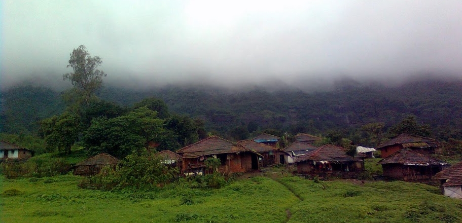
Pali is a small village off Mumbai-Goa Highway. It is home to one of the eight asta-vinayakas and is popular by name Ballaleshwar Ganpati. I had visited this place earlier during my NCC trip, but the fort was little known to me then.

On a saturday, I had to catch the first local train from Dadar i.e 4.23 AM, which I did and caught a window seat. Well, don't laugh...everyone has a gusto for that :p  Being a slow-local,so my journey till Khadavli station was like watching a paint dry. Others, including  Anup Desai, Nitish Bapat, Anish Bapat, Prasanna Padgaonkar were waiting for me at Khadavli station. So train made a 'mirthy' travel till khopoli.

A shot from train near Badlapur at around 5.30am!!
At khopoli bus stand our wait for Naadsur or pali bus was filled with a cup of tea and bread-sauce. We took a State Transport Bus (Laal Dabba) from Khopoli ST stand to reach pali village (About 1 hour journey). At pali it was time to fulfill our first energy booster- vada paav, misal paav and coffee. And we were all set for the climb.

The fort can be easily spotted by its distinctive 1600 feet height, behind the Temple. Though not much of geographical prominence, it was seldom used by the Britishers. But Shivaji Maharaj used this Fort as a sentinel to guard nearby region. It is said that he used 2000 Hons (Currency) for its reconstruction.

After about a walk of 20 minutes we came across this plateau, from where we got a first-rate view of Tel-Baila; an excellent spot for Rockcimbers. 


Proceeding ahead, we successfully maneuvered the Rock-cut steps and arrived at the base of 97 steps,
each of them were 2 foot high (yes, we counted each and every step while ascending them- Dindi Darwaza).

The stairway is well guarded by two bastions on its either sides. And at the end of the stair-way lies the main entrance to the Fort or Maha Darwaja. Here I got an opportunity to click a puzzling-pic. Have a look-

Sarasgad has a mammoth pinnacle, towering to a height of about a 100 feets, and the fort's citadel lies atop. Reaching the top needs a 3/4th circumambulation to the pinnacle. But the heart of Sarasgad lies underneath this Pinnacle !! 


With about 8-10 Caves, and water tanks inside each of the caves, these served an excellent hiding for soldiers and a prime option for food storage, back then. Here are few snaps...

Iron Man ?

Sarasgad Apartments !!!


Exploring a 3 BHK Cave !!
As compared to other Fortress, Sarasgad is lilliputian. Even though its full of surprises. We were truly lucky to find these.

That's a Snake !!

That's a Snake-skin
Having fully explored each and every cave the two bastion, we proceeded to the citadel. The Kedareshwar Temple, a Lake beside it, Ancient Flag post and panoramic Tail-Baila, Sudhagad are the star attractions. Everyone was starving as we had fully explored the fort, having left no stones unturned. It was time for second boost-up, and the hungry tummies devoured the 10 Aloo Parathas in no time, without anyone bothering to use chutney.

Temple at the top
From up here, one can easily keep a watch on the activities carried out in nearby region. Hence Sarasgad  was mostly used as a watch-post. Though the fort lies in a dilapidated condition its tough Bastions, stone cut steps, Flora and fauna makes it a Thriller. I think its high time for Archeological Survey of India to start 'working'.

We started the return journey at 3.15 pm and barely letting the minute hand touch 4.00 we reached Pali and  downed a couple of sugarcane juices each, along with misal paav & two extra paav. Then, as planned we visited the Temple and spent a couple of minutes there, waiting for  the 5.00 pm bus to khopoli. We reached khopoli ST standat 6.30 and there, pleaded an auto driver to carry 5 passeggers to khopoli station. We boarded the train, watched the stations pass by, until it was a Asta-la-vista baby moment for us. Until we meet again !!!

Trek to Raigad : King of all forts

Height: 2700 ft
Location: Mahad, Maharashtra, INDIA
Best time to visit would be through the year. From food, water and shelter everything is available on the top. 

Raigad fort, a Military stronghold during Shivaji Maharaja's era, resides near Mahad, Raigad district in Maharashtra. Towering to a height of 2700 ft. above sea level, it has a prominent place in Sahyadri Mountain Ranges. 

If you are going to do the walking to the top of the Fort, it will take you about an hour and half. Otherwise for  Lazy people and those who hate walking, there is a Ropeway that will take you up in less than 15 min. The real beauty is hidden along the walking trail, and cable-car misses out these aspects. 

In the mid February, when you are tied up with the lectures and practicals, and when the tight schedule is freaking you out, what you need is a mini-vacation that will refresh you and increase your working efficiency!! So managing the time a little bit,  I decided to join my uncles at Raigad, the then capital of Shivaji Maharaj. Though it was my 3rd visit to the Royal fort, it was this visit that was going to be on the blog. 

This trek wasn't a pre-planned or something like that. I got a call from my uncle at 4.30pm on saturday evening saying they were going to Raigad Fort for a quick visit and would be returning the next day. But I had to attend two wedding Receptions at two different places on the same saturday. I had to manage it all. Well, I did, and reached Ambernath station at 11.00pm where my uncle and the rest were waiting for me. We left at around 11.15pm in his Tata Sumo, very thrilled, as it was going to be a night drive!! 

We were finally on the Highway before crossing midnight, enjoying the darkness of night. And while watching the spooky roads on outskirts of town I realised I was on verge of sleep. At ~ 1.00am we stopped for Tea ( which was really good n tasty). And after staying awake for an hour I continued with my job. We reached pachad at 3.00am, a village to the base of Raigad Fort, and had to sleep inside the car until first hotel was opened. A breakfast at Hotel Deshmukh at 6.00am  helped us regain some power and at ~7.30am, we started off enjoying the Sahyadri Ranges, with the golden tops, bathing under morning sunlight. !! 


The fort reminds me of the Discovery show - The Extreme Engineering, which features futuristic and ongoing Engineering projects. But this 'project' was built way back in the year 1030 and fully upgraded during the Maratha Ruler Shivaji Maharaj in the year 1656 !!

Extreme Engineering : Raigad Fort
The Architect : Hiroji Indulkar ( of course, under the guidance of the great Shivaji)

Two birds in one shot( Purpose of Hatti TalaoBefore building any fort atop a mountain, first factor to be considered is availability of water throughout the year. Secondly, the prime need is the requirement of the rocks used in construction of  the fort. So the purpose of Hatti talao was to fulfill the second need, and in the end we have a lake filled with water ready to use!!! It is said that Elephants were washed here.

Hatti talao(lake)- 30 ft. deep!!
Maha Darwaza (Main Entrance): In any battle, a war is half-won once the Fort-gates are downed. Special war Elephants were used to break down the gates. A couple meters run-up is enough for the elephants to gain momentum to break it down. Taking these fatal risks into consideration, Shivaji Raje designed the Main entrance in such a way that only a 10 metre space was left in front of the door & a sharp  90deg. turn, which gave no room for Elephants to gather any momentum to strike the door!!!
हा महा-दरवाजा हस्ती-नखाच्या आकाराचा आहे. या दरवाजाच्या बाहेरील भागाला "जिभी" असे म्हणतात. या रचनेचे वैशिष्ट्य असे- शत्रूच्या हत्तीला जास्त जागा मिळत नाही (दरवाजाला धडक द्यायला). 
Similar door-construction can be found on Sudhagad fort. The main-door (while ascending from Dhondase village) has a similar हस्ती-नखाच्या and "जिभी".

रायगड चे २ बुलंद बुरुज 
Acoustics: As a king , it was Shivaji Maharajas duty to communicate freely with his people (or rather make his subjects communicate freely with the king ). So the Darbar was so designed that even a whispering of <20dB at a corner could be heard crystal clear from the throne. Don't back-talk ,talk freely in the court; was his intention. Truly a Jaanta Raja.


Motherly love (The story of Hirkani Buruj): As a story goes.....After sunset all the doors leading to the fort used to be closed and opened only on next morning. Hirkani was a milkmaid who daily brought milk to the fort & went home before sunset. One day she was late to reach the gate & sun was already down and the gates closed. It was up to the guards to follow the kings orders & not to open gates till sun was up. Desperate as she was, only problem she was facing was how to reach her helpless baby at the fort base. Only option left with her was of the steep slopes guarding the forts. With all her determination & will she climbed down the steep cliff, fighting the thorny bushes and the rough route, just to feed her baby in time!!! Next day, the guards were surprised to see her at the gates with a fresh can of milk;suspiciously they took her to the Shivaji Raje where she narrated the whole incident. Shivaji Maharaj not only praised her courageousness, but also ordered   his unit to construct a steep protective wall, and named it 'Hirkani Buruj'. 

A shot from base
courtesy- D90
This wall was built after the incident
Market place (Bazaar peth): 


It was said people used to shop here riding on the Horseback, without the necessity of getting down. Some counter this fact saying that these cubicles were residential buildings. On the fort, as secure as Raigad, there could be no such place dedicated for market, and allowing an outsider to do business here would prove vulnerable. Well, the fact is still unknown. 

The head of the Bazaar owned the shop with this carving
Other Miscellaneous Carvings/Sculptures :


The Incredible Sahyadris:

Courtesy D-90
Lingana
It was a marvellous Trek to  the Capital of  Shivaji Maharaj and I didn't even get a slightest feeling that I had been here before !! I dunno why, the fort keeps on Refreshing from time to time!!

[Climbing] Mumbra 14th Feb. 2012

Date: 14th February, 2012
Location: Mumbra, Maharashtra, INDIA

My father, an avid trekker, introduced me to this place some 5-6 years back. 


If you are a frequent traveler of Central Railway in Mumbai, you must be quite familiar to Mumbra station, the one after Thane, and the inimitable Rock structure, guarding the Mumbra-devi temple. And not far from the approach steps to the temple, lies about 10 to 15 odd number of boulders, which is an ideal place for Bouldering. Mumbra is gifted with many small natural Boulders about max. 15-20 feet high.


Best part of Mumbra is that it can serve as a perfect half-day hangout. Packing a day's lunch, 2 ltr water bottle, reaching early morning, and enjoying the Rocks until sun gets overhead, and returning back around 3.00 PM would be perfect half-day hangout. Before taking the return route we threw a visit to the temple on the top of hill. 

This place has some boulders for beginners too, but its not recommended for first timers to travel alone. It is better to go with someone experienced. Here is the link to my new another visit to Mumbra. 

Trek to Tikona fort (Vitangad)

Difficulty Rating : Easy
Height: 3580 ft
Location: Malavli (Pune), Maharashtra, INDIA
Per head cost- 210 ₹

Route: Dadar-Lonavala (Express train), Lonavala-Kamshet (Shuttle train), Kamshet-Kale Colony-Tikona Peth (by road). Trek starts at Tikona Peth and a easy trail climbs to the top in 45 minutes. It is recommend to combine the trek to Tung fort with Tikona fort. 

My semester vacations had just begun which was supposed to be the best time for my projects and explore some technical aspects in tronix!!! But nothing much was happening around. Even my circuits were not showing much of intrest in my hardwork. In the first week of January, I got a call from Anup Desai, an Engineering friend, asking me to join his group to Tikona fort, Maval region. Well, I am eveready for any treks!! So we fixed a holiday for the visit.

We caught a first train in the morning to Pune Indryani Express and got down at Lonavla station. A local train was waiting for us & we started our journey towards Kamshet (Lonavla-Malavli-Kamshet). It was really nice to see the vacant  footboard of that local train which is rarely seen in suburbans!! Most of the passengers were sitting quietly, wearing sweaters, wrapped in shawls, blankets and staring at us, tryig to listen our conversation. A group of foreigners, Germans I guess, were enjoying the fine chilly morning & the picturesque of nearby forts. The renowned twin forts Lohagad-Visapur can be easily spotted from the train near Malavli station. After arriving at kamshet and getting our tummies filled with medu wada ,vada paav and cup of  coffee we approached the town bus stand. As we moved on, an amusing notice caught our eye which read...

पुणेरी पाट्या 
At the bus stop we couldn't spot a single bus, but tum-tums & jeeps all around. A nearby paanvala told us that ST would be coming in 5 min. So we waited, waited till the 25th minute was over and decided to take a jeep upto Tikona peth, the village from which the trail starts. We were startled when he told us the fare..700/-.....coz it was too much for a couple of kilometres. We asked the 6-seater auto rikshaw guy, and he told us that they dont travel that far & we will have to take a jeep. Nothing is certain about the ST buses..If the ST bus is scheduled to arrive in 5min, the bus may even turn up after 50-150 min...We were left with no choice but jeep.

Tung Fort & Pawna Backwaters

The road to Tikona peth is full of sharp curves, steep slopes & excellent for those who love adventure driving. The panoramic beauty of Tung fort & Pawna Dam to the right adds a particular gusto to the adventure.

First view from Tikona  Peth
A ~0.5 Km walk on dusty road leads to a parking lot, is the place where the actual trek starts. The trail is clearly visible and the chances of losing it are null thus making the trek pretty easy.We climbed the first slope in ~15 min. and traversed the ridge and arrived at the base of the hillock on which the fort stands.


Along the way there are many noteworthy locations which cant be missed. We came across an amusing carving of Lord-Hanuman, चपेटदान मारुती (Lord Hanuman appears to be slapping a devil under his foot). We clicked a lot of pics here, including a huge Boulder & a tree.

The Ridge climbs to the top. Tung can be seen on right. 
The places worth visiting at the top: The Mahadev temple (महादेवाचे मंदीर), चुन्याचा घाण, पाण्याच्या टाक्या etc. The fort walls are still standing and the main entrance door look sturdy too. The view from the top is amazing, as always. The forts of Visapur, Lohgad, Tung, Bhaat rashi mountain can be seen from the top. 


It was splendid experience to drink naturally chilled water from the water cisterns. The water is available on the fort throughout the year & never dries, the very reason behind building a fort up here !!!! Having filled our water-bottles, we started our descent from the fort and reached Tikona Peth. Every one was hungry & was eagerly waiting to gobble the goodies our mom's had packed for our lunch!!! The temple at the base can be used as the resting place. 

Tung fort, surrounded by Pawna Dam.
It was a perfect trekking day, spent perfectly with equally adventurous group. After coming home  I debugged my audio Amplifier circuit. I really thank Anup for letting me borrow his Nokia C5 for clicking some of the awesome pics & hats off to the old repaired F-80 for not giving any errors.

Trek to Lohagad fort

Height: 3450 ft
Location: Malavali (Pune), Maharashtra, INDIA

Lohagad is famous for its excellent Fortification, eminent Architecture and its famous 'Vinchukata Machi' aka the fortification like Scorpion's tail & machi in marathi means plateau. Lohagadwadi (Base village) can be directly approached by road or by train from Malavli station, next station from Lonavala. Once you get down at Malavli station there is a road which will take you directly to Lohagadwadi. On the way, there are many sites worth visiting, the prominent among them being Bhaje Caves.

Our first destination was Bhaje caves.


A 100 steps climb leads to the first-rate Indian Rock-cut architecture.Bhaje Caves is not far from location of Karla Caves and these are stylistically similar to Karla Caves.Bhaje caves, situated at malavali near Lonavala , pune district are a group of ~22 Buddhist rock-cut caves of First centuary BC located at the foothills of Lohagad-Visapur forts.One can easily notice the catchy features like huge dome shaped prayer hall, 14 stupas & some carvings. 

Having spent a few minutes in a waterfall nearby we started our trek to Lohagad .

Note: No need to get down by the steps again. There is a trail which descends down the slope and takes you to the main road (muddy road) we followed that route and saved a kilometer walk for us !!

Lohagad-Visapur, the twin forts share the same plateau & hence the same approach route, except that from the T junction the road to the right goes to lohagadwadi and a left turn for Visapur fort. (No chance for any wrong turns)

As mentioned earlier the approach route to this fort is damn simple; just a few 'steps' away  from lohagadwadi.

Visapur fort
(The fortification is visible from the base)
History of Lohagad:

Lohagad has a long & stirring history. It was ruled by many dynasties right from Satavahans, Chalukyas, Nizamshahi, Mughals to the Great Maratha King Chhatrapati Shivaji Maharaj. Shivaji Maharaj captured the fort in 1648 right after conquering Torna.Netaji palkar was given the responsibility of looking after the fort. Lakshmi kothi was used to store the treasure raided from surat. In the treaty of purandar 1665, Lohagad was lost to Aurangzeb, under Mirzaraje Jaysingh. Shivaji Maharaj Recaptured this fort in 1670.Aurangzeb recaptured it after Shivaji Maharajs death in 1700 ; and after the peshwas it finally went in hands of Colonel prother.

Worth watching:


There are four main entrance to the fort namely Narayan darwaza, Ganesh darwaza, Maha darwaza, Triambakeshwar darwaza & Hanuman darwaza, the latter being the oldest of em' all. The main gate is also known as 'Delhi Gate'. All the Darwaza has some notable carvings on it which you can't miss. Carving of lord Hanuman on Hanuman Darwaza is its prominent feature.The Durgah, Octagonal reservoir,  few Cannons, other cisterns & panoramic view of Tung-Tikona, Visapur, Pawna Dam add to the list.


And regardless of the Rule of the different dynasties, destruction caused by the constant battles, wrekage by the English rulers, the Fort stands Strong, as tough as Iron & deserves the name Lohagad!!!!

Group photo
(Don't search me, u wont find me here, coz i clicked it)

Trek to Nakhind

Difficulty Rating : 3/5
Height : 2300 ft
Location: Vangani, Maharashtra, INDIA

The march to the base

Nakhind (नाखिंड) is known for its naturally formed 'gap' in the hill, as if a hole has been punched through it. In marathi, it is called nedha (नेढ)  or a needle-hole.There are very few forts having this kind of peculiar geographic formation like Rajgad, Madangad....

How to reach:
Go to Vangani station (central railway). Take the back-side exit (towards CST). Take the small road and reach highway. You can now see another road on the opposite side leading to the village. Cross the highway and keep walking along the straight road. After reaching the village anyone can guide you from there. 

Nakhind trek is much similar to Chanderi trek with long approach route to the base and then the actual trekking trail. Every monsoon sees the formation of a waterfall, which is a perfect hangout for picnickers and those who don't like trekking.

The dirt track to the base is surrounded by paddy fields and fascinating landscapes. 


A 3-4 km walk brought us to a small village.The trek starts from that point onwards.We never got a chance to see the hill from the base, it was engulfed in fog all the time, and the rains made sure the this situation continued.


On our way we came across many streams and rivulets. Don't try to protect your shoes from getting wet, as anyway they are going to get more than wet. What awaited us was a wide, knee deep water channel .It was fun crossing this brook ,slipping on small stones and falling in the water; and getting out of water, fully soaking wet, and same time for  the wind to blow hard enough to make u shiver !!


U'll get to see another tiny brook, which transforms into a mini waterfall every monsoon .It was so very tempting that every one had enough fun under it, and that actually help to restore our energy to climb the final steep slope. This slope will directly take u to the top. After reaching the top one needs to traverse along the mountain ridge to reach the final destination. Walking on this ridge, with deep valley on both sides and the trail lost in fog was a thrilling experience.


The trail ends near a huge pinnacle like rock. From this rock a left turn and a few steps took us to this alluring  form of nature.

A hole right thru mountain!!
Completely 'aarpaar'
Actually the space at the top is very less and it can accommodate some 8-9 people at a time; and the same reason being I couldn't capture the whole of the 'gaping' in my NOKIA 2700. The fog completely restricted the visibility, otherwise we could have got a stunning sight of forts of Matheran range.


Nakhind is perfect for one-day trekking destination. I would recommend taking a guide with you if you are not confident with the route. This visit was planned with my father (Dilip Phal) and his friends.

Our most recent adventure...

Chanderi fort trekking

Date: January 2021 Trek type: Jungle fortress, 714 m Difficulty: Walking on moderate to difficult terrain (no rock-climbing) Availability of...