Pages

Vadgaon - Kudpan - Pratapgad Trek Photolog

वडगाव - कुडपण - प्रतापगड : एक स्वर्गीय अनुभव
Date: 11th & 12th July 2015

Got an wonderful opportunity to do this heavenly trek with Arun Sawant Sir and his team. We started from Mumbai on friday night and reached Vadgaon the next morning at 6.00 AM. Vadgaon is a picturesque village nestled in the thickly forested mountains. It was dry in Mumbai, but the scenario was completely opposite here. We were surrounded by 1000 shades of greenery (not 50) with torrential streams making their way through the valley. We crossed the col (महार खिंड) to reach the other side of the mountain to Kudpan village. Our night stay was arranged at Javjibuva's home. In the evening I accompanied Pramod Sir to see the Bhimachi Kathi (भीमाची काठी) pinnacle and the famous 1000ft. waterfall. The final day trek was Kudpan to Pratapgad. It was a long walk along the ridges of the nearby mountains. The route was pretty simple. There were a few exposed patches but with proper caution they were negotiable. In contrast to the calm and quiet atmosphere of the trek, Pratapgad was booming with vociferous crowd and uproarious vehicles. We were back by Sunday 9.30 PM. I was trying to recollect the memories of my previous trek here. I did find out a few new things on this trek.  

Note: Shelar Khind (शेलार खिंड), a pass (col) which takes you from Kudpan to Pratapgad is no more. It was demolished recently (somewhere after 2010, not sure when) while making the roadway. I am lucky that I had been here when I was a child. I thank my parents for bringing me here and for having shown me this historical route. Now no such col exist, but a much simpler route takes you from Kudpan to Pratapgad
.

Trek starts from here, right in front of the temple. 
The trail takes you into the forest and climbs gradually.
We crossed the water-stream twice.
There is a nice waterfall near the second crossing. 
Reached the famous Mahar col (महार खिंड). 
Found this near the col. Locals call it पानविंचू 
Getting down from the other side of the col to reach Kudpan
This is the Mahar col.
Col allows us to pass from one side of mountain range to another.
Moss on the rocks
A natural loop
Reaching Kudpan village
You can still fight outside the village border.
Reached Kudpan village. 
They look healthy. 
Total height of this waterfall is about a 1000 ft.
This is just a part of it.
Bimachi Kathi pinnacle (या सुळक्याचे नाव भीमाची काठी)
River Jagbudi (जगबुडी नदी) 
Reaching Pratapgad the next day. Mahabaleshwar is on the
left side. The tar road is visible from here.
Reaching Pratapgad
Thats Pratapgad !!

Waterfall Rappelling at Bhivpuri

Date: 7th July 2015

This was my first activity with ropes and equipments after my basic course at JIM & WS in the month of April at Pahalgam, Kashimr. Last activity was Dukes Nose upper 350 ft. rock-climbing in the month of February, 2015. Suraj had already completed his Advance course from NIM, Uttarkashi. Pramod Chavhan Sir and Anjali Parab (tai) had also successfully completed their basic course from HMI, Darjeeling recently. They offered me a warm invitation to join the rock-climbing community visit to Bhivpuri road for a waterfall-rappelling event. I joined them without hesitation and I was among the total 9 people (all friends).

Group photo clicked using timer
Group: 
(Left to Right) Suraj Malusare, Pramod Chavhan Sir, Vishal More, Vedika, Anjali tai, Ashwini
(Back Left to Right) Me, Neha More, Sameer Sir 

Nearest railway station is Bhivpuri road. Exit from the railway track towards Karjat side and take the immediate right turn after crossing the railway tracks (safely). Road after that is pretty straightforward. People trekking to Matheran via Garbett point often use this route. 

Dhom


Bhivpuri is a well known weekend destination among nature lovers and trekkers. Its vicinity and closeness to the city makes it famous to the (filthy) alcoholic community as well. It was our luck that it was a Tuesday and trust me, we literally owned the place for that day!! Free from boisterous crowd !! Our equipment and our gear- rappel as many times as you want !!

It was Pramod Sir's birthday and सेलिब्रेशन तो बनता है बॉस !! How and from where we got the Monginis cake was another long story which I wont write here! And why we all will remember this day is also another important story, a quite memorable one if you would ask me.

We prepared the base with the help of a two boulders- one for rappelling and the other for belay. Due to the poor rains in July, there wasn't much water left in the waterfall. But the bare minimum was enough for our activity. 

Tai went first and I gave her belay. Next I went and Sameer Sir & Suraj looked after the belaying. Later, turn by turn, everyone followed. Even young Vedika wasn't afraid and completed the activity flawlessly. The intermittent rains added to the fun while rappelling. Pramod Sir did an amazing rappell (in an sarcastic way !!). We watched the video over & over &  over. 

Anjali Parab

Me

Vedika

Sameer Sir

Suraj Malusare
At about 1.30 PM Suraj asked us to start with the wrap-up. We started the rope coiling and after every equipment was gathered, every carabiners, harnesses, gloves and descenders etc were counted. After this we sat down for our lunch.

Pohe, Batata Vada, Bread, Batata Bhaji, Eggs, Chapati, Farsaan etc...
While returning majority of us voted for a swim in the dam water. We searched for a safe spot and enjoyed a lot. At about 4.30 PM we started for Bhivpuri road and were back home by 7.30 PM. 

Note: A villager told us that the water here is not at all safe for swimming. The water from waterfall when enters the dam flows with such a tremendous force that if caught in the stream, it pulls you down. And the worst part is that the force of these monsoon streams cannot be seen from the top. Water simple appears calm. We thanked the villager and left for the station. So if you plan to visit Bhivpuri, just visit the waterfall and go. But for a dip, see where the village kids are enjoying themselves. 

Photo Credits: Suraj Malusare, Sameer Sir

Trek to Rajmachi [लोणावळा ते कर्जत]

Date: 3rd & 4th July, 2015
Night Trek
Water available at Udhewadi Village, Sreevardhan & Manaranjan top
Route: CST - Lonavala - Tungarli - Sreevardhan - Manaranjan - Udhewadi - Kondhane - Khandpe - Karjat - Dadar
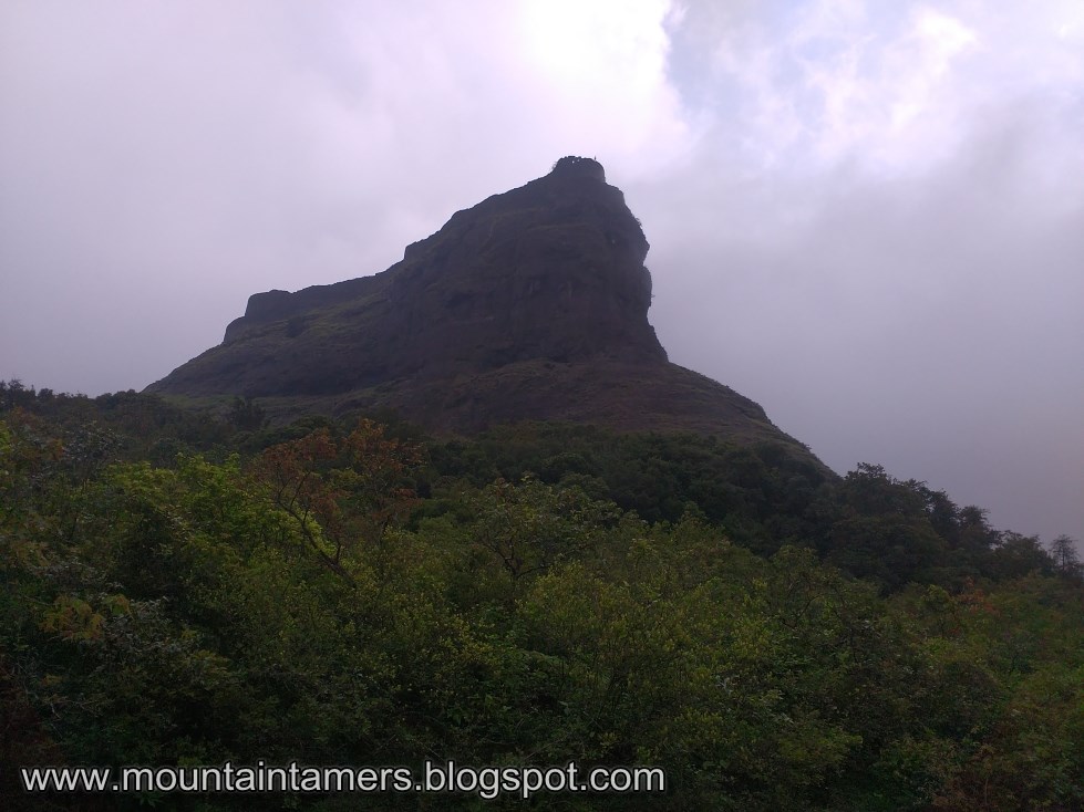
Shreevardhan 
Three of us Aaditya, Ninad & I, we boarded the midnight Passenger train at CST to Lonavala station and Abhash & Tarun joined us at Thane. For Aaditya, Abhash & Tarun, it was their first 'Night trek' and even the location was decent- Rajmachi. To avoid the boisterous crowd & vehicular traffic at Rajmachi, we decided on a night trek, wherein we could experience the nocturnal beauty of the place of the surrounding flora & fauna.

Lonavala to Rajmachi:

The train entered the platform at 2.10 AM. Our plan was to buy the Maganlal chikki (मगनलाल चिक्की) from the authorized dealer near the ST Bus stand. So with a map in my hand and a torch to show the way, we marched to our destination. The Bus stand was well lit and we could see many people getting ready for trek to nearby locations. It was decided that we walk all the way to Tungarli lake and leave as early as possible and spend the time in the forest patch of the trek. A vada pav (वडा पाव ) and a cutting चहा each, and we were on our way to Tungarli.

It was 2.30 AM and the whole town was asleep. Crossing the landmarks- the HDFC bank, Lonavala Gramin Police Station, HDFC training centre etc. etc. etc.. we reached a spot where whole part of the road was dug up. Luckily, a 1ft. narrow and 4 mtr. long plank was put up across the huge pit and we crossed it successfully to reach the other end of the road. The streets were deserted and the only sound was of us chatting. By 3.00 AM we crossed the Pune-Mumbai Express highway, which officially marked the beginning of our trek. The tar road ends here.

From Tungarli lake the path is well laid out till Udhewadi village. Somewhere after the farmhouse, a huge Owl swooped past us. Well, there were no street lights and without our LED torch lights, it was pitch dark in there. Except for a few fire-flies which came out and disappeared behind a nearby bush.

At 4.00 AM
At about 4.00 AM we decided to take a short break. We sat down on the road where the crowd usually gathers up in the day-time for Rappelling etc. activities. There were no signs of rain but the weather was pleasant and the clouds had started accumulating by now.

At 6.00 AM
Near the stream. Theres a bridge under construction here.

At 5.30 AM, the pre-dawn glow crept across the jungle, peering first through the tangled branches and then inching through the thicket of forests. The late night sounds of cicadas now was filled by the singing of the birds. As planned, we reached the small river by 6.00 AM and got freshened up. A dip in the chilled water was so tempting that we spend a full 20 minutes in the stream. Now fully awake, the next stop was Shreevardhan top. The breakfast of an apple and a (कचोरी) kachori, and we were off again.
Abhash Kumar- He can make water come out of his fingers !!! 
We also crossed the land-mark titled 'Rajmachi border fortification' built and maintained by Maharashtra Tourism, where we can see some existing wall like structure and a temple of Ganesha-Hanuman. As we approach the Udhewadi village, we can see a series of old caves.


A well laid path takes us to the col dividing the two citadels. The temple of Kaal bhairav lies at the col separating the two citadel. There are many idols in the temple courtyard. A unique piece is an idol of a horse (its unique because it cannot be seen else where on any other forts). The old dismantled canon, unknown goddess idol, and many carvings are worth noting at the col. 

Horse like carving
Canon

Kaal Bhairav temple
Shreevardhan:

The route to the top is well laid before the temple, which climbs up gradually in a zig-zag manner and enters through the main entrance of the fort. The entrance houses some old construction that resembles a corridor. Further beyond, we come across an old rusty canon-like thing and many water cisterns. The trail to the top runs along the edges of the citadel hence be careful.

Bastion and a secret door, at Shreevardhan
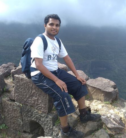
Tarun Kaushik- Its my Sofa !!
Near the topmost point of the fort, we had a heavy breakfast and then explored the forts bastions. It was cloudy and windy at the same time. We were expecting rains but had to be contented with just the thundering. The fort has lots to explore.

Manaranjan:

The route starts from the left side of the temple (facing the temple). The trail passes through the forest patch and meets another trail from the village. The main entrance of this citadel was still intact. There are many cisterns and remnants of construction on top. We can also descend directly to the Udhewadi village.

Aaditya Gurav
Ninad bhau Vilankar !!
Shreevardhan from Manaranjan
Udhewadi Village from Manaranjan
Descend to Karjat:

After a quick inquiry at Udhewadi village we started our second part of our journey- descend down to Karjat. We had spared some time for visiting the Buddhist caves (temple) at Kondhane as well. The trail till the col is a straight laid-out path. But the later part was a steep descend and the trekkers climbing up from Karjat looked really tired and frustrated. Well, for us, we were less concerned as we had about 8 Ltr. water and enough food supply left with us. It was 2 PM when we reached the Kondhane caves diversion and we could still see people starting their trek to Rajmachi. Many picnic-groups had set-up a camp on a nearby plateau. A traverse from that campling place (about 20 minutes) will take you to the caves. We had a small surprise waiting for us there- a waterfall! Without second thoughts we sat beneath the magnificent waterfall. 

With all the non-stop walking we had done since the last night it was the most wanted and a most deserving thing for us. 

At karjat station we downed a jumbo glass of sugarcane juice each and got ready for a long nap- till Dadar station !!

Photo credits: Aaditya Gurav, Tarun Kaushik & Ninad Vilankar

Our most recent adventure...

Chanderi fort trekking

Date: January 2021 Trek type: Jungle fortress, 714 m Difficulty: Walking on moderate to difficult terrain (no rock-climbing) Availability of...